
Hidden gem
Kotla Fort, Kangra
A Forest Approach to the Ruins above Latehr
At a glance
- Location
- Kotla near Latehr, Kangra district
- How to reach
- Kotla on the Pathankot–Mandi road
- Walking difficulty
- Uphill path with uneven ground around the ruins
Climb through pine woods above Kotla to see old arches and masonry on a ridge overlooking the surrounding valleys.
🌄 Location and how to reach it
The fort is above Kotla near Latehr on the Pathankot–Mandi road. The state heritage list places it under Shahpur tehsil. Use the Kotla Fort and Latehr names when asking for directions.
Google Maps: Find Kotla Fort
- By road: Ask for Kotla near Latehr and confirm an off-road parking or drop-off point before leaving the highway.
- By public transport: Check which local services stop at Kotla and confirm the return. Allow time to get back to the main road after the walk.
- On foot: Ask for the established uphill path and ask whether visitors can reach the ruins that day. Use the same route back.
🌸 Best time to visit
Dry mornings suit the uphill walk and the uneven ground around the ruins. After rain, wet stone and pine needles can make the descent slippery. Check local access before driving out specifically for the fort.
🏰 What survives on the ridge
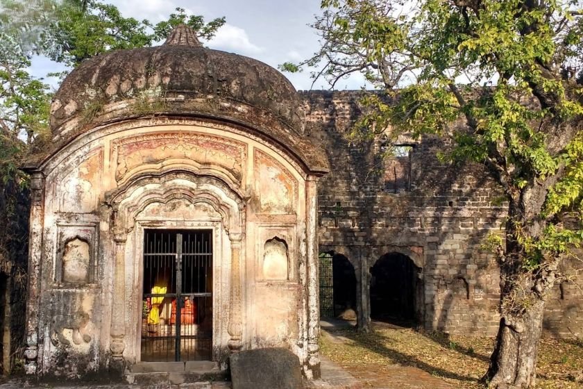
Himachal Tourism attributes the fort to the rulers of Guler and draws attention to surviving arches and niches. Look at how those openings are set into the walls. The ridge also gives a sense of how a hilltop fort could command the valleys below. Stay on firm ground around the masonry.
👣 Fort and shrine at the approach
The state’s Kangra temple portal places a Bagalamukhi shrine at the fort doorway. Ask locally which parts of the approach are accessible and follow shrine instructions if visiting. Keep away from broken wall tops and leave daylight for the forest descent.