
Treks & nature
Dainkund Trek
The Ridge Walk to Pohlani Mata near Dalhousie
At a glance
- Location
- Dainkund ridge above Dalhousie, Chamba district
- How to reach
- From Dalhousie, travel via Lakkarmandi to the Dainkund roadhead.
- Walking difficulty
- Short uphill walk followed by an exposed ridge to Pohlani Mata.
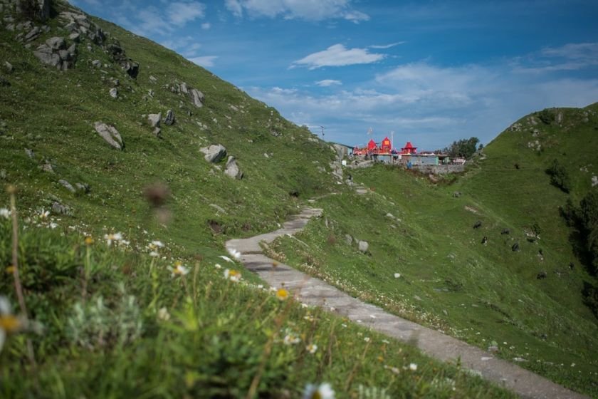
Climb from the Dainkund roadhead to an open ridge above Dalhousie, then follow the temple path to Pohlani Mata and return by the same route.
🥾 Trek at a Glance
- Route: Dainkund roadhead to Pohlani Mata temple and back along the ridge
- Time and terrain: Allow half a day from Dalhousie including the drive. Walking distance varies with the vehicle drop-off.
- Difficulty: Short uphill walk followed by an exposed ridge.
🌄 Location and how to reach it
From Dalhousie, take the road towards Lakkarmandi, then the Dainkund approach. Arrange a return pickup at the public trailhead.
Google Maps: Find the trailhead
If travelling without your own vehicle, arrange the return ride from Dalhousie before you set out. Confirm the last accessible vehicle stop that morning.
🗺️ The Trail, Stage by Stage
- Roadhead to the ridge. Start on the public temple path. The initial ascent accounts for much of the effort, so leave time for a breather when you gain the ridge.
- Along the ridge to Pohlani Mata. On a clear day, look across the hills towards Khajjiar. Keep to the signed temple route.
- Temple to the roadhead. Retrace the same path. The descent back to the vehicle stop can take longer on wet steps and loose ground.
🌤️ Best Time and Access
Spring and autumn usually offer options for a dry day walk. Choose a clear morning for the views and ask locally about snow or road closures in winter.
🎒 What to Carry and When to Turn Back
Take water, a windproof layer and shoes with grip. If cloud obscures the path or thunderstorms develop, turn back along the known approach.
Distance from Dainkund to the temple
The Forest Department’s sanctuary management plan lists 2 km for the Dainkund–Pohlani footpath. Allow about 4 km out and back if you start at the same point listed in the plan. Walking from a lower vehicle stop adds distance. At the Dainkund roadhead, follow the public temple path and observe posted access directions near the Air Force station.
Kalatop–Khajjiar management plan, Annexure XI · Incredible India’s Dainkund visitor page