
Hidden gem
Jaitak Fort, Sirmaur
The Ridge Above Nahan and the Anglo-Gorkha War
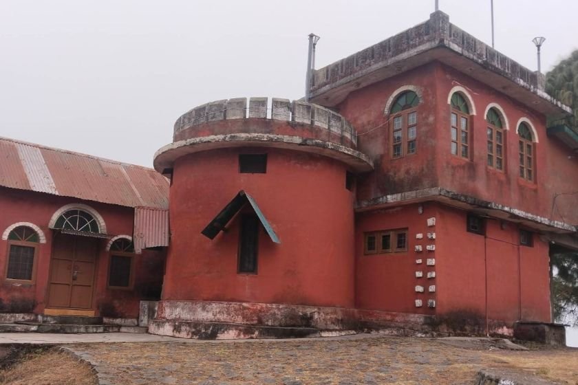
At a glance
- Location
- Jaitak ridge near Jamta, Sirmaur district
- How to reach
- Follow the Nahan–Dadahu road to Jamta and confirm the uphill Jaitak approach
Above the Nahan–Dadahu road, the ridge at Jaitak helps explain how a Gorkha force held a hill position against British troops.
Jaitak is a short detour on a map, but the rise from Jamta is central to the visit. The fort is remembered for an episode of the Anglo-Gorkha War. Its setting is part of the evidence: the ridge is high above the surrounding approaches and made a difficult position to attack.
🌄 Location and how to reach it
The ridge is near Jamta, Sirmaur district, off the Nahan–Dadahu road. Sirmaur district describes an ascent of about 3 km from Jamta. Ask locally where the present walk starts and whether any part of the side approach can be reached by vehicle.
Google Maps: Find Jaitak Fort, Sirmaur
- By road: Head from Nahan towards Dadahu and ask for the Jaitak turn at Jamta. Confirm the permitted parking point at the start of the approach.
- By public transport: Ask for a service that drops at Jamta and check the return before leaving Nahan. Keep enough time for the uphill and downhill legs.
- On foot: Expect an uphill approach. Go in daylight, carry water and follow the public route. Check the condition of the walk after rain.
🌸 Best Time to Visit
A dry, clear morning gives you time to make the ascent and see the surrounding hills. The ridge is the focus of the visit, so visibility matters. Ask locally about access if heavy rain or repairs have affected the route.
📜 Ranjor Singh Thapa and the Fort
Sirmaur district attributes the fortress to Ranjor Singh Thapa, a Gorkha commander associated with the occupation of Nahan around 1810. The district census handbook gives some of the political background. Karam Parkash sought Gorkha assistance during a struggle over the Sirmaur throne, and the Gorkhas then took control of the territory. Jaitak belongs to the events that followed that occupation.
🏰 Why the Ridge Mattered
During the Anglo-Gorkha War, British troops advanced towards Nahan and attacked the Gorkha position at Jaitak. District history records heavy British losses and says the Gorkhas remained entrenched until they evacuated under a treaty arrangement. The older Sirmaur gazetteer likewise records an unsuccessful initial assault.
On the approach, look at how much height has to be gained from the road. From a public viewpoint, look back towards the route you climbed. That view gives more context to the battle than a date alone.
👣 Visiting the Ridge
Expect a historic ridge and fort site with limited interpretation. Ask what remains are accessible and stay on public paths. Keep away from unstable walls and steep edges. If a local memorial is open, spend a few minutes there to see how the landscape is remembered today.
❓ Quick Questions Travellers Ask
- Where does the uphill approach begin? Ask for Jaitak from Jamta on the Nahan–Dadahu road.
- Is the district’s three-kilometre figure a walking distance from parking? It refers to the ascent from Jamta. Check where you will actually leave the vehicle and begin walking.
- Can I combine it with Nahan? Yes. Keep enough daylight for the ridge before returning to town or continuing towards Dadahu.
A Final Thought
Take a moment on the ridge to trace the approach back towards Jamta. That line through the hills helps explain why Jaitak is remembered in Sirmaur’s history.