
Treks & nature
Raghupur Fort Trek from Jalori Pass
A Forest Climb to the Ruined Walls of Outer Seraj
At a glance
- Location
- Jalori Pass, Ani tehsil, Kullu district
- How to reach
- From Jibhi via Shoja to Jalori Pass, then on foot to the fort and back.
- Walking difficulty
- Moderate day hike with a short, steep climb to an exposed meadow.
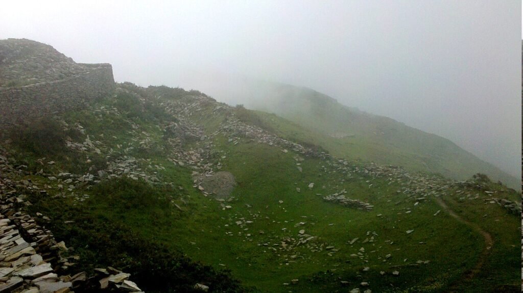
From the tea stalls at Jalori Pass, the westward trail slips into oak forest before climbing onto an open ridge. Low lines of stone in the grass mark the remains of Raghupur Garh.
🥾 Trek at a Glance
- Route: Jalori Pass → forest path → fort meadow → Raghupur ruins → return to Jalori Pass.
- Distance and time: Allow two to three hours from Jalori Pass and back, including time at the ruins. Peaks N Valleys maps the route at about 2.5 km each way. HimLocal recorded about 1.8 km on its approach, so treat the shorter distance as specific to that track and start. Add the drive from Shoja or Jibhi separately.
- Difficulty: Moderate on a dry trail. The forest approach is gentle, but the climb to the meadow is steeper and the ridge is exposed to wind.
🌄 Location and how to reach it
Jalori Pass is the roadhead between Banjar and Ani in Kullu district. From Jibhi, travel uphill through Shoja. Agree on a pickup time at the pass with your driver. If travelling by bus, check that day’s service in both directions before leaving the valley.
Google Maps: Find the Jalori Pass trailhead.
🗺️ The Trail, Stage by Stage
- Choose the westward trail. Start by the roadside stalls at the pass and ask for the westbound footpath to Raghupur Garh. The path leaves the road here and soon enters the forest. The Serolsar Lake walk heads east from the same roadhead.
- Follow the forest to the open slope. On the Peaks N Valleys itinerary, the first kilometre is level or gently downhill. The main climb begins as the trees thin. Wet grass can make the descent slippery.
- Look for the walls in the meadow. The surviving masonry is low. Walk beside it and leave the stones where they lie. The state archaeology inventory records Raghupurgarh in Ani tehsil. The inventory identifies the site by name and location. The age and builder of the surviving walls remain uncertain.
- Return to Jalori. Retrace the forest path and allow for the short rise back to the road. The Forest Department also lists routes from Bahu through Bachhut and Lagishar. Those longer itineraries require separate transport planning.
🌤️ Best Time and Access
May and June and the clearer weeks of autumn are usual planning windows. Snow can close the pass road or hide the path. Monsoon cloud can obscure the point where the forest opens onto the ridge. Ask about both road and trail conditions in Shoja on the morning of the walk.
🎒 What to Carry and When to Turn Back
Fill your water bottle before leaving the pass. Bring a warm layer, rain cover and shoes with grip for the descent. If cloud begins to hide the return line, turn back while you can still recognise the forest path. Leave enough daylight to meet your ride.
Sources and Further Reading
- Himachal Pradesh Department of Language, Art and Culture — official heritage listing.
- Forest Department route register, routes 90 and 91 — Bahu-side routes and surviving walls.
- Peaks N Valleys route notes — mapped pass-to-fort walk, terrain and round-trip timing.
- HimLocal recorded approach — separately measured approach from the pass.
- Photograph of the ruins by Nathan Pratyksh Khanna, via Wikimedia Commons, CC BY-SA 3.0.

Photo by Nathan Pratyksh Khanna, Wikimedia Commons · CC BY-SA 3.0