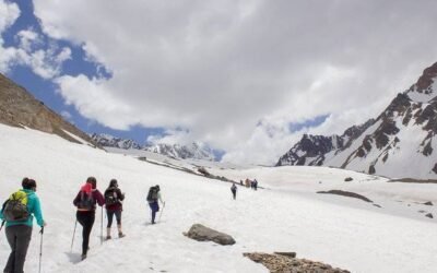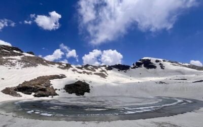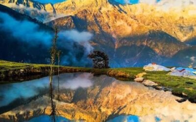
The trail from Billing to Rajgundha is one of those quiet Himalayan walks that rewards you without demanding too much in return. It connects the famous paragliding launch site of Billing with the remote and largely untouched village of Rajgundha, passing through open meadows, dense oak and rhododendron forests, and ridgelines with sweeping views of the Dhauladhar range. For anyone based in Bir Billing who wants a day in the hills without a technical climb, this hike fits perfectly.
Rajgundha is a small pastoral settlement that sees far fewer visitors than the paragliding crowds at Billing. Shepherds bring their flocks here during the warmer months, and the village retains a calm, unhurried character. The trail itself is well-worn by locals and is manageable for reasonably fit walkers, including those with limited trekking experience. Children and older adults who are comfortable walking on uneven terrain can also attempt it with some preparation.
This guide covers everything you need to plan the Billing to Rajgundha hike sensibly, from how to get to the starting point and what to carry, to where to stay and when to go. All practical details should be confirmed locally before you set out, as conditions in the hills can change with the seasons.
Why Billing to Rajgundha Hike is Famous
Billing is internationally known as one of the best paragliding sites in Asia, and most visitors come specifically for the flying. However, the surrounding landscape offers excellent walking terrain that goes largely unnoticed by the paragliding crowd. The Billing to Rajgundha trail has quietly built a reputation among hikers who prefer a peaceful forest walk over the bustle of the launch site.
Rajgundha itself draws attention because it feels genuinely remote despite being reachable on foot in a single day. The village sits in a broad valley with views of snow-capped peaks, and during spring the surrounding slopes are covered in wildflowers. The combination of an accessible starting point, a scenic route, and a rewarding destination makes this one of the more satisfying easy hikes in the Kangra district.
About Billing to Rajgundha Hike
The hike begins at Billing, which sits at roughly 2,400 metres above sea level. The trail descends and then climbs through forested terrain before opening into the Rajgundha valley. The total one-way distance is generally described as around 9 to 11 kilometres, though the exact figure can vary depending on the path taken. The walk typically takes between three and five hours at a comfortable pace.
The route is not technically demanding. There are no steep rock faces, river crossings requiring ropes, or high-altitude passes. The main challenges are the uneven forest path, some moderate ascents, and the possibility of slippery sections after rain. The trail is used regularly by local villagers and shepherds, which means it is generally easy to follow, but carrying a local guide or asking for directions at Billing before you start is always a sensible step.
Most visitors do this as a day hike, returning to Bir or Billing by evening. It is also possible to spend a night in Rajgundha and return the next morning, which allows you to experience the village at a quieter time of day and see the morning light on the peaks.
Location of Billing to Rajgundha Hike
Billing is located in the Kangra district of Himachal Pradesh, approximately 14 kilometres from the town of Bir. Bir Billing is accessible from Dharamsala and Mandi, and sits in the lower Himalayan zone of the Dhauladhar range. Rajgundha lies further into the hills from Billing, in a valley that is accessible only on foot or by mule track.
The broader area falls within the Kangra valley region, which is known for its Buddhist monasteries, tea gardens, and paragliding infrastructure. The Billing to Rajgundha trail runs roughly northward from the launch site into progressively quieter terrain. The nearest major town for supplies and transport connections is Bir, and Dharamsala or Palampur can serve as larger base cities for those travelling from further away.
Quick Trek Details
| Detail | Information |
|---|---|
| Trek Name | Billing to Rajgundha Hike – Easy Himalayan Village Trail |
| District / Region | Kangra |
| Content Group | Full Trek Guides |
| Article Type | Village Hike |
| Starting Point | Billing |
| Difficulty Level | Easy |
| Best Time to Visit | April to June, September to November |
Trek Route
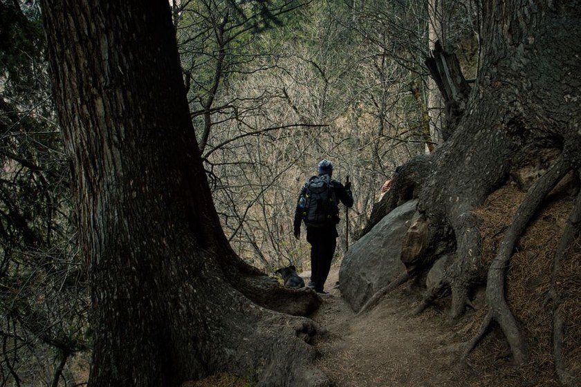
The hike starts at the Billing paragliding launch site. From here, the trail moves away from the open meadow and enters a mixed forest of oak, rhododendron, and pine. The initial section involves a gradual descent before the path begins to climb again through the forest. This forested stretch is the longest part of the hike and provides good shade during warmer months.
After clearing the main forest section, the trail opens up onto a ridgeline with views of the surrounding peaks and valleys. This is a good spot to rest and take in the landscape before the final descent into the Rajgundha valley. The last section of the trail drops down into the valley floor where the village sits, surrounded by terraced fields and grazing land.
The route is generally clear and used regularly by locals. However, there are points where the path branches, and it is easy to take a wrong turn without local knowledge. Asking for directions at Billing before you start, or hiring a local guide, is strongly recommended for first-time visitors. Trail conditions can also change after monsoon rains, so always check locally before setting out.
Suggested 2-Day Itinerary
This itinerary assumes you are based in Bir and want to combine the hike with an overnight stay in Rajgundha.
Day 1: Bir to Billing to Rajgundha
Start early from Bir and make your way up to Billing by road, either by hiring a vehicle or arranging transport through your accommodation. Reach Billing by mid-morning, have a light breakfast or snack, and begin the hike. Walk at a comfortable pace through the forest and along the ridge, stopping to rest and take in the views. Arrive in Rajgundha by early afternoon. Spend the rest of the day exploring the village, talking to locals, and watching the evening light settle over the valley. Stay overnight at a local homestay.
Day 2: Rajgundha to Billing to Bir
Wake up early to catch the morning views of the peaks. Have breakfast at your homestay and begin the return hike to Billing. The return journey follows the same trail in reverse. Reach Billing by late morning, arrange transport back down to Bir, and spend the afternoon resting or exploring Bir’s cafes and monasteries.
If you prefer a single-day outing, the hike can be done as an out-and-back walk in one day. Start as early as possible from Billing to give yourself enough time for the return journey before dark.
How to Reach Billing to Rajgundha Hike Starting Point
By Road
Bir is the most practical base for this hike. It is connected by road to Dharamsala, Mandi, Palampur, and other towns in Himachal Pradesh. From Bir, Billing is approximately 14 kilometres up a winding mountain road. Shared taxis and private vehicles are available from Bir to Billing, particularly in the morning when paragliders are heading up. Confirm transport availability and timings locally, as schedules vary by season. The road to Billing is steep and narrow in sections, so travel in daylight.
By Air
The nearest airport is Gaggal Airport, also known as Kangra Airport, located near Dharamsala. From the airport, Bir is roughly 60 to 70 kilometres by road. Taxis are available from the airport. Flight availability and fares vary considerably by season, so check and book in advance. Bhuntar Airport near Kullu is another option, though it is further from Bir.
By Train
The nearest broad-gauge railway station is Pathankot, from where you can take the narrow-gauge Kangra Valley Railway to Ahju or Baijnath Paprola, both of which are close to Bir. The narrow-gauge train is a scenic journey but runs on a limited schedule. From Ahju or Baijnath, local taxis or buses can take you to Bir. Confirm train schedules with Indian Railways before travel, as timings change.
Best Time to Visit Billing to Rajgundha Hike
The best months for this hike are April to June and September to November. During April and May, the rhododendrons are in bloom and the forest trail is at its most colourful. Temperatures are pleasant at altitude, though mornings and evenings can still be cool. June brings warmer days but the trail remains walkable before the monsoon arrives.
The monsoon season, roughly July to mid-September, brings heavy rainfall to this region. The trail can become slippery and difficult to navigate safely during this period, and leeches are common in the forest. It is advisable to avoid the hike during peak monsoon unless you have local guidance and are prepared for wet conditions.
September and October are excellent months, with clear skies, good visibility of the peaks, and comfortable walking temperatures. November is still manageable but temperatures drop noticeably, and higher sections may see early snowfall. Always check the weather forecast and local conditions before setting out, regardless of the month.
Difficulty Level of Billing to Rajgundha Hike
This hike is rated easy and is suitable for most reasonably fit adults and older children. There are no technical sections, no high-altitude passes, and no requirement for special equipment. The trail involves some moderate ascents and descents through forested terrain, and the path can be uneven and rocky in places.
People who walk regularly and are comfortable on uneven ground should find this hike manageable. Those who are not used to walking for several hours at a stretch should pace themselves, take regular breaks, and carry sufficient water. The altitude at Billing is around 2,400 metres, which is not high enough to cause serious altitude sickness for most people, but those coming from sea level should allow a day or two to acclimatise in Bir before attempting the hike.
Food, Water and Stay Options
In Billing, there are small dhabas and tea stalls that cater to the paragliding crowd. You can have a meal or snack here before starting the hike. Do not rely on finding food or water along the trail itself, as there are no established stops between Billing and Rajgundha.
Carry at least two litres of water per person from Billing. There may be natural water sources along the route, but it is not advisable to drink from these without purification. Carry water purification tablets or a filter if you plan to use stream water.
In Rajgundha, local homestays offer basic accommodation and simple meals. The food is typically home-cooked Himachali fare, which is wholesome and filling. Availability of homestays can vary by season, and it is worth asking your accommodation in Bir to help you make contact with a Rajgundha family in advance. Do not assume accommodation will be available on arrival without prior confirmation.
Mobile Network and Facilities
Mobile network coverage in this area is patchy and unreliable. Billing has some connectivity, but the signal drops significantly once you enter the forest trail. Rajgundha village has limited or no reliable mobile network. Do not depend on your phone for navigation or emergency communication during the hike.
Download offline maps of the area before you leave Bir. Inform someone at your accommodation in Bir about your plans, your expected return time, and the route you are taking. There are no ATMs, medical facilities, or shops along the trail or in Rajgundha. Carry cash, any personal medication, and a basic first aid kit from Bir before you set out.
Things to Carry for Billing to Rajgundha Hike
- At least two litres of water per person
- Packed snacks and a light lunch (energy bars, nuts, fruit, sandwiches)
- Sturdy walking shoes or trekking shoes with good grip
- Light rain jacket or windcheater
- Warm layer for the morning and evening
- Sunscreen, sunglasses, and a hat or cap
- Basic first aid kit including bandages, antiseptic, and blister plasters
- Personal medication if required
- Fully charged mobile phone with offline maps downloaded
- Small daypack or rucksack to carry all the above comfortably
- Trekking poles if you prefer support on uneven terrain
- Torch or headlamp with spare batteries
- Insect repellent, particularly during and after monsoon
- Cash in small denominations for dhabas and homestays
- A copy of your ID
Safety Tips for Billing to Rajgundha Hike
Start the hike early in the morning. This gives you enough time to complete the walk and return before dark, and you will avoid the afternoon heat during summer months. Do not start the hike after midday if you are planning an out-and-back trip in a single day.
Check the weather forecast before you leave. Mountain weather can change quickly, and rain makes the forest trail slippery and more difficult to navigate. If the forecast shows heavy rain or thunderstorms, postpone the hike.
Tell someone your plan before you set out. Let your guesthouse or a trusted contact know your intended route, your expected time of arrival in Rajgundha, and when you plan to return. This is a basic safety step that is easy to overlook.
Hire a local guide if this is your first time on the trail. The path is generally clear, but there are junctions where it is easy to take a wrong turn. A local guide also adds safety in the unlikely event of an emergency. Ask at your accommodation in Bir or at Billing for a reliable guide.
Do not hike alone. At minimum, go with one other person. If you are a solo traveller, try to join a group or hire a guide who can accompany you.
Carry a basic first aid kit and know how to use it. Blisters, minor cuts, and twisted ankles are the most common issues on easy trails. Treat these promptly to avoid them becoming bigger problems.
Respect the forest and the village. Do not light fires along the trail, do not disturb wildlife, and do not leave litter. Rajgundha is a small community and the goodwill of local residents is important for all future visitors.
Nearby Places to Visit
Bir
Bir is the base town for the Billing area and is well worth spending time in. It has a Tibetan colony with monasteries, a growing cafe culture, and a relaxed atmosphere. The town is small enough to explore on foot and makes a comfortable base for the hike.
Billing Paragliding Launch Site
Even if you are not flying, the Billing launch site offers excellent views of the Dhauladhar range and the Kangra valley below. Watching the paragliders take off is an experience in itself, and the open meadow is a pleasant place to sit and have tea before or after the hike.
Baijnath Temple
Located near Baijnath town, this ancient Shiva temple is one of the most significant religious sites in the Kangra valley. The temple complex dates back several centuries and is architecturally impressive. It is easily reachable from Bir by road.
Palampur
Palampur is a small hill town known for its tea gardens and views of the Dhauladhar range. It is roughly an hour from Bir by road and makes a pleasant half-day excursion. The tea gardens are particularly attractive during the growing season.
Dharamsala and McLeod Ganj
Dharamsala, home to the Tibetan government in exile and the residence of the Dalai Lama, is a couple of hours from Bir by road. McLeod Ganj, the upper part of Dharamsala, has monasteries, markets, and a lively traveller scene. It is worth a day trip if you have time to spare around your hike.
Google Maps Location
Search for Billing, Himachal Pradesh on Google Maps to find the starting point of this hike. Rajgundha village can also be found on Google Maps, though the trail between the two points may not be fully mapped. Download offline maps of the area before you leave Bir, as mobile data is unreliable on the trail. Confirm the exact trailhead location with your accommodation or a local guide in Bir before you set out.
Responsible Travel Tips
Carry all your rubbish back with you. There are no waste collection facilities on the trail or in Rajgundha. Plastic bottles, wrappers, and food packaging should be packed out and disposed of properly in Bir.
Use a reusable water bottle and refill it where safe to do so. Buying single-use plastic bottles repeatedly adds to the waste problem in mountain areas.
Support local homestays and dhabas rather than bringing all your food from outside. Spending money locally helps the communities that maintain the trail and welcome visitors.
Ask before photographing people, particularly in the village. Rajgundha residents are not a tourist attraction, and basic courtesy goes a long way in maintaining good relations between visitors and local communities.
Stay on the established trail. Cutting across switchbacks and walking off-path damages vegetation and accelerates soil erosion on slopes.
Keep noise levels down in the forest. The area has wildlife, and loud noise disturbs animals and detracts from the experience for other walkers.
If you hire a local guide, pay a fair wage and tip appropriately. Ask your accommodation in Bir for guidance on what is considered a reasonable rate.
FAQs About Billing to Rajgundha Hike
Is the Billing to Rajgundha hike suitable for beginners?
Yes, this hike is rated easy and is suitable for beginners who are reasonably fit and comfortable walking on uneven terrain for several hours. There are no technical sections or high-altitude challenges. First-time hikers should start early, carry enough water and snacks, and consider hiring a local guide for added confidence on the trail.
Do I need a permit to do this hike?
No permit is known to be required for this hike at the time of writing. However, regulations can change, and it is always worth confirming locally in Bir or Billing before you set out. Ask your guesthouse or a local guide for the most current information.
Can I do this hike as a day trip?
Yes, most people do this as a day hike, walking from Billing to Rajgundha and returning the same way. Start early from Billing to give yourself enough time for the return journey before dark. An overnight stay in Rajgundha is also a good option if you want a more relaxed experience.
Is it safe to hike alone?
It is not recommended to hike alone on any mountain trail, including this one. Go with at least one other person, or hire a local guide. Solo travellers should inform their accommodation of their plans and expected return time, and should carry a fully charged phone with offline maps.
What is the best way to get from Bir to Billing?
Shared taxis and private vehicles travel from Bir to Billing, particularly in the morning. Your guesthouse in Bir can usually help arrange transport. The road is steep and narrow in sections, so travel in daylight. Confirm availability and cost locally, as these vary by season.
Are there accommodation options in Rajgundha?
Yes, local homestays in Rajgundha offer basic accommodation and home-cooked meals. Availability is limited and can vary by season. It is strongly advisable to arrange your stay in advance through your accommodation in Bir rather than arriving without a booking. Do not assume a bed will be available on arrival.
What should I do if the weather turns bad on the trail?
If you encounter heavy rain, strong winds, or reduced visibility on the trail, stop and assess the situation. If conditions are deteriorating, turn back towards Billing rather than continuing. Do not attempt to push through in poor visibility or on a slippery trail. Check the weather forecast before you start and build a buffer into your plans so that you are not under pressure to complete the hike regardless of conditions.
Last Word
The Billing to Rajgundha hike is a genuinely rewarding walk that offers a different side of the Bir Billing area, one that most visitors never see. The trail is accessible, the scenery is beautiful, and Rajgundha village provides a glimpse of Himalayan rural life that is increasingly rare in more visited parts of Himachal Pradesh.
Plan carefully, start early, carry what you need, and check conditions locally before you go. The hike does not demand much of you technically, but it does reward those who approach it with a little preparation and respect for the environment and the community at the other end.
If you have done this hike or have updated information about the trail, homestay availability, or transport options, sharing that knowledge with other travellers helps everyone plan better. The hills are best enjoyed when people look out for each other.