The Rajgundha Valley Trek is a quiet, rewarding trail that connects the paragliding hub of Bir Billing with the forested town of Barot in Mandi district. Unlike the more crowded Himalayan circuits, this route passes through a hidden pastoral valley that most visitors to Himachal Pradesh never discover. Shepherds graze their flocks here through summer, and the landscape shifts steadily from pine-covered ridges to open meadows and rushing streams.
The trek suits those who want genuine mountain solitude without the technical demands of a high-altitude pass crossing. The trail is well-used by local herders, which means the path is generally traceable, but it is remote enough that you will need to plan your supplies and accommodation carefully before setting out.
Whether you start from Bir on the Kangra side or from Barot in the Uhl River valley, the route offers a satisfying cross-district journey through landscapes that feel largely unchanged. This guide covers everything you need to plan the trek responsibly and realistically.
Why Rajgundha Valley Trek is Famous
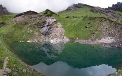
Rajgundha Valley has earned a quiet reputation among trekkers who have grown tired of overcrowded trails. The valley itself is a broad, grassy expanse ringed by forested slopes, and it sits at an elevation that gives clear views of the surrounding Dhauladhar and Uhl watershed ridges. The combination of Bir Billing’s fame as a paragliding destination and Barot’s reputation as a trout-fishing and camping spot makes this connecting trail a natural choice for travellers who want to link two well-known areas on foot rather than by road.
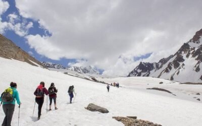
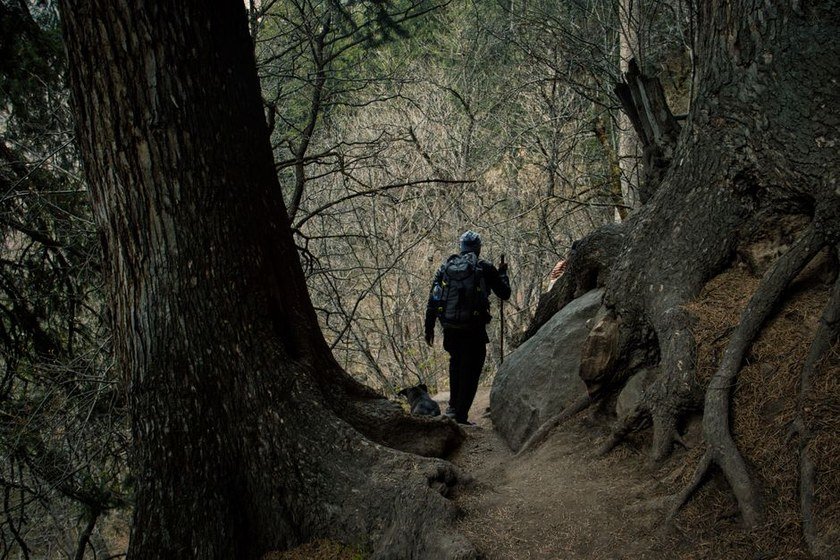
The trek is also notable for its cultural texture. The Gaddi shepherd community uses these high pastures seasonally, and encounters with herders and their flocks are common. The trail passes through dense deodar and oak forests, open bugyals, and small seasonal settlements, giving a rounded picture of mountain life in this part of Himachal.
About Rajgundha Valley Trek
The Rajgundha Valley Trek is a moderate-grade trail that links Bir Billing in Kangra district with Barot in Mandi district via the Rajgundha meadow. The route is typically completed over three to four days, depending on your pace and the direction you choose to travel. Most trekkers begin at Bir or at the Billing launch site and descend toward Barot, though the reverse direction is equally feasible.
The trail climbs from Bir through forests and small villages before opening into the Rajgundha Valley, a wide pastoral bowl that serves as the midpoint of the trek. From Rajgundha, the descent toward Barot follows the Uhl River drainage through increasingly dense forest. The total elevation gain and loss is moderate, making it accessible to trekkers with basic fitness and some prior hill-walking experience.
There are basic guesthouses and homestays in Rajgundha village, which makes an overnight halt there both practical and comfortable. Beyond the village, the trail becomes less serviced, so carrying sufficient food and water purification is advisable.
Location of Rajgundha Valley Trek
The trek spans two districts of Himachal Pradesh. The Bir end lies in Kangra district, roughly 70 kilometres from Dharamsala and accessible from the Pathankot–Mandi highway. The Barot end lies in Mandi district, reached via Jogindernagar. The Rajgundha Valley itself sits between these two points at a mid-range elevation in the Dhauladhar foothills, forming a natural corridor between the two drainage systems.
Barot village sits along the Uhl River and is well known as a base for camping and fishing. Bir is internationally recognised as one of the best paragliding sites in Asia. The trail connecting them through Rajgundha is the most direct walking route between these two destinations and passes through terrain that is administratively shared between Kangra and Mandi forest divisions.
Quick Trek Details
| Detail | Information |
|---|---|
| Trek Name | Rajgundha Valley Trek – Bir Billing to Barot Side Trail |
| District / Region | Kangra/Mandi |
| Content Group | Pass Treks |
| Article Type | Valley Trek |
| Starting Point | Bir or Barot |
| Difficulty Level | Moderate |
| Best Time to Visit | May to June, September to October |
Trek Route
The standard direction runs from Bir toward Barot, though many trekkers also do it in reverse. Starting from Bir, the trail climbs through the tea gardens and village lanes that characterise the lower slopes. The path rises through mixed forest before reaching the Billing plateau area, from where the descent into the Rajgundha Valley begins.
Rajgundha village is the central landmark of the trek. It is a small settlement with basic facilities, and the surrounding meadows are used as grazing grounds by Gaddi herders. From Rajgundha, the trail continues through forest and along stream channels before dropping into the Uhl River valley and arriving at Barot.
The route involves a mix of forest paths, open meadow walking, and some rocky sections near stream crossings. Stream levels can rise significantly after rain, so crossing timings matter. Confirm the current state of the trail with locals or your guesthouse host before each day’s walk.
Suggested 4-Day Itinerary
Day 1 – Bir to Billing and onward to forest camp or first halt
Begin at Bir and walk or take a vehicle to the Billing launch site. From Billing, the trail descends into the valley on the far side. The first day involves getting your bearings and covering the initial descent. Camp or stay at a suitable point along the trail as advised by your guide or local contact.
Day 2 – Onward to Rajgundha Valley
This is typically the most scenic day. The trail opens into the broad Rajgundha meadow, with views of the surrounding ridges. Arrive at Rajgundha village by afternoon. Stay in a local homestay or guesthouse. Spend the evening exploring the meadow and interacting with local herders if present.
Day 3 – Rajgundha to Barot descent
The descent toward Barot follows forest trails and stream-side paths. The gradient is steady rather than steep for most of the way. Arrive at Barot by afternoon. Barot has better facilities, including guesthouses, a forest rest house (subject to availability), and small dhabas.
Day 4 – Buffer day or departure from Barot
Use this day as a buffer for weather delays, or explore Barot’s surroundings including the Uhl River and the Shanan Powerhouse area. Arrange onward transport to Jogindernagar or Mandi from Barot.
How to Reach Rajgundha Valley Trek Starting Point
By Road
Bir is connected by road to Pathankot, Dharamsala, Mandi, and Chandigarh. Regular HRTC buses and private taxis operate on these routes. From Bir, local vehicles can take you to the Billing launch site if you prefer to begin the trek from that elevation. Barot is reached via Jogindernagar, which is connected to Mandi and the broader Himachal road network. Road conditions vary seasonally, so confirm route status before travel, particularly after monsoon.
By Air
The nearest airport to Bir is Gaggal Airport (Kangra Airport) near Dharamsala, approximately 70 kilometres away. Flights connect Gaggal to Delhi and a few other cities, though schedules and availability change frequently. From the airport, hire a taxi to Bir. For the Barot side, the nearest airport is also Gaggal or alternatively Bhuntar Airport near Kullu, depending on your onward route. Confirm current flight operations before planning.
By Train
The nearest broad-gauge railway station to Bir is Pathankot, from where you can take a bus or taxi. The Kangra Valley narrow-gauge railway (Pathankot to Jogindernagar) passes through the region and stops at Ahju, which is relatively close to Bir. For the Barot side, Jogindernagar is the nearest narrow-gauge station. Train schedules on the narrow-gauge line should be verified in advance as they are subject to change.
Best Time to Visit Rajgundha Valley Trek
The two recommended windows are May to June and September to October. In May and June, the meadows are green, wildflowers are beginning to appear, and the weather is generally stable before the monsoon arrives. Temperatures are comfortable for walking, and the trail is accessible after winter snowmelt.
September and October offer clear skies after the monsoon, excellent visibility of the surrounding ridges, and cooler temperatures that make walking pleasant. The vegetation is lush from the rains, and the streams are still flowing well. October can turn cold toward the end of the month, particularly at night, so carry adequate warm layers.
Avoid the monsoon months of July and August. Heavy rainfall makes trails slippery, stream crossings dangerous, and landslides a real risk on approach roads. Winter from November onward brings snow to the higher sections of the trail, and the route may become impassable without proper equipment and experience.
Difficulty Level of Rajgundha Valley Trek
This trek is rated moderate. It does not require technical climbing skills or specialised equipment, but it does demand reasonable physical fitness and prior experience of multi-day hill walking. The trail involves sustained ascent and descent over several hours each day, and the terrain includes uneven forest paths, rocky stream crossings, and open meadow sections where the path can be less defined.
First-time trekkers should consider hiring a local guide, not only for navigation but also for safety on stream crossings and in case of sudden weather changes. Those with experience of similar Himalayan valley treks will find the route manageable with standard preparation.
Food, Water and Stay Options
Bir has a good range of cafes, restaurants, and guesthouses catering to the paragliding and backpacker crowd. Stock up on snacks and any specific supplies you need before leaving Bir, as options become limited once you are on the trail.
Rajgundha village has basic homestays that typically offer simple meals. Availability can vary by season, and it is worth confirming in advance through a local trekking operator or by asking in Bir. Do not assume accommodation will be available without prior checking, especially outside peak season.
Barot has guesthouses, a forest rest house (booking required through the forest department), and small dhabas. It is a more established base than Rajgundha and offers more reliable food and stay options.
Water sources exist along the trail in the form of streams and springs, but treat or filter all water before drinking. Carry a reliable water purification method. Do not rely on finding clean drinking water at every stage of the trail.
Mobile Network and Facilities
Mobile connectivity is reasonable in Bir and Barot but becomes patchy or absent on the trail between them. BSNL tends to have the widest coverage in remote Himachal areas, but even this cannot be guaranteed in the Rajgundha Valley section. Do not depend on your phone for navigation or emergency communication while on the trail.
Carry a physical map or download offline maps before departure. Inform someone at your guesthouse or a trusted contact of your planned route and expected arrival times. ATMs are available in Bir; carry sufficient cash for the trek as there are no banking facilities in Rajgundha or on the trail.
Things to Carry for Rajgundha Valley Trek
- Sturdy trekking shoes with good ankle support and grip
- Warm layers including a fleece jacket and a windproof or waterproof outer shell
- Rain poncho or lightweight rain jacket, especially if trekking near monsoon edges
- Trekking poles, useful for stream crossings and descents
- Daypack and a larger rucksack if camping
- Sleeping bag rated for temperatures that may drop to near zero at night
- Water bottles and a water purification method (filter, tablets, or UV pen)
- High-energy snacks such as nuts, dry fruit, energy bars, and biscuits
- Basic first aid kit including blister plasters, antiseptic, pain relief, and any personal medication
- Sunscreen, lip balm, and sunglasses
- Headlamp with spare batteries
- Offline maps downloaded to your phone and a physical backup map if possible
- Sufficient cash for the entire trek
- Personal identification documents
- Lightweight camp towel and basic toiletries
- Trekking permit documentation if required (verify locally before departure)
Safety Tips for Rajgundha Valley Trek
Always check the weather forecast for both the Kangra and Mandi sides before starting each day. Mountain weather can change quickly, and what begins as a clear morning can turn into heavy rain or mist by afternoon. If conditions look uncertain, wait or turn back.
Stream crossings are one of the main hazards on this trail, particularly after rain. Never attempt a crossing if the water level looks high or the current is strong. Wait for levels to drop, or seek an alternative crossing point with local guidance.
Hire a local guide if you are unfamiliar with the trail. The path through the forest sections can be unclear, and a guide who knows the terrain is a practical safety measure, not just a convenience. Ask your guesthouse in Bir or Barot to recommend a reliable guide.
Start each day’s walk early to give yourself maximum daylight. Avoid walking in the dark on unfamiliar mountain trails. Build buffer days into your itinerary so that a weather delay does not force you to rush through difficult sections.
Acclimatise properly if you have arrived from low altitude. Although this trek does not reach extreme elevations, rapid ascent can still cause headaches and fatigue. Drink water regularly and do not push through symptoms of altitude sickness.
Carry a fully charged power bank and keep your phone battery conserved for emergencies. Let someone know your daily plan and check in when you reach each halt point.
Nearby Places to Visit
Bir Billing
Bir is the landing site and Billing is the launch site for paragliding in this area. Even if you are not flying, the views from Billing over the Kangra Valley are exceptional. The Bir Tibetan colony has monasteries, cafes, and a calm atmosphere worth spending time in before or after the trek.
Barot Village and Uhl River
Barot is a pleasant base in its own right. The Uhl River is a designated trout-fishing zone, and the surrounding forest is good for short walks. The Shanan Powerhouse, one of the oldest hydroelectric projects in Himachal, is a short distance from Barot and worth a visit.
Jogindernagar
The nearest town to Barot, Jogindernagar is the terminus of the Kangra Valley narrow-gauge railway. It is a functional town rather than a tourist destination, but useful for transport connections and supplies.
Dharamsala and McLeod Ganj
Roughly 70 kilometres from Bir, Dharamsala and its upper town McLeod Ganj are the seat of the Tibetan government in exile and home to the Dalai Lama’s residence. The area has monasteries, museums, cafes, and excellent trekking routes of its own. It makes a natural add-on to a Bir-based trip.
Palampur
Known for its tea gardens and views of the Dhauladhar range, Palampur is between Bir and Dharamsala on the Kangra Valley road. It is a relaxed town with good accommodation and a pleasant climate, suitable for a rest day before or after the trek.
Google Maps Location
Search for Rajgundha Valley, Himachal Pradesh on Google Maps to get a general orientation of the valley. For navigation to the starting points, search Bir, Kangra or Barot, Mandi depending on your direction of travel. Offline maps are strongly recommended for use on the trail itself, as connectivity is unreliable in the valley. Download your maps before leaving your base.
Responsible Travel Tips
Carry all your non-biodegradable waste back out of the trail. There are no waste collection facilities in Rajgundha or on the forest sections of the route. Plastic bottles, wrappers, and packaging must come back with you.
Use established camping spots rather than clearing new areas. If you are camping, use a camp stove rather than an open fire, particularly in forested sections where fire risk is high and firewood collection damages the ecosystem.
Respect the Gaddi herders and their animals. Do not disturb livestock, and ask permission before photographing people. These communities live and work in this landscape year-round and deserve courtesy from visitors passing through.
Stay on the marked trail where one exists. Cutting across switchbacks causes erosion and damages the slope vegetation. On meadow sections, spread your footfall rather than following a single line that can create a rut.
Support local homestays and guides rather than bringing in outside operators who do not reinvest in the local economy. Buying food and services locally in Bir, Rajgundha, and Barot directly benefits the communities along the route.
FAQs About Rajgundha Valley Trek
Is the Rajgundha Valley Trek suitable for beginners?
The trek is rated moderate and is best suited to those with some prior experience of multi-day hill walking. Complete beginners can attempt it with a good local guide and adequate physical preparation, but it is not recommended as a first-ever trek. Build up with shorter day hikes before attempting this route.
Do I need a permit for the Rajgundha Valley Trek?
Permit requirements can change and vary depending on the season and local forest department policies. Do not assume the trail is permit-free. Confirm current requirements with a local trekking operator in Bir or Barot before you start. Carry your identification documents regardless.
Can I do the trek without a guide?
Experienced trekkers with good navigation skills and offline maps have completed this route independently. However, for most visitors, hiring a local guide is strongly recommended. The trail can be unclear in forested sections, stream crossings require local knowledge, and a guide provides a practical safety net in case of injury or weather changes.
What is the best direction to trek – Bir to Barot or Barot to Bir?
Both directions are feasible. Bir to Barot is more commonly done and involves a net descent overall, which many trekkers find more manageable. Barot to Bir involves more sustained climbing. Your choice may also depend on your onward travel plans after completing the trek.
Are there ATMs or medical facilities on the trail?
There are no ATMs or medical facilities on the trail between Bir and Barot. Withdraw sufficient cash in Bir before starting. Carry a well-stocked first aid kit and any personal medication. The nearest hospitals are in Dharamsala on the Kangra side and Mandi on the Mandi side. In a serious emergency, evacuation would need to be arranged with local help.
What wildlife might I encounter on the trail?
The forests along the route are home to a range of Himalayan wildlife including langur monkeys, various bird species, and potentially barking deer. Larger animals such as leopards are present in the broader region, though sightings on this trail are uncommon. Make noise while walking through dense forest sections to avoid surprising animals, and do not leave food unattended at camp.
How do I get from Barot back to Bir after completing the trek?
There is no direct road connection between Barot and Bir. From Barot, take a vehicle to Jogindernagar, then connect by bus or taxi toward Mandi or Pathankot, and from there toward Bir via the Kangra Valley road. The road journey is significantly longer than the walking route. Plan your return transport in advance, particularly if you have a flight or train to catch.
Last Word
The Rajgundha Valley Trek rewards those who take the time to plan it properly. It is not a trail you can walk into without preparation, but it is also not one that demands extreme fitness or technical skill. What it does ask for is respect – for the terrain, the weather, the local communities, and your own limits.
If you are looking for a Himachal trek that feels genuinely off the beaten path while still being logistically manageable, this route between Bir and Barot is a strong choice. The Rajgundha meadow alone is worth the effort, and the satisfaction of walking between two well-known destinations through a valley that most visitors never see makes this a trek that stays with you.
Plan carefully, travel responsibly, and confirm all local details before you set out. The mountains are always worth the preparation.