
Treks & nature
Manimahesh Lake Trek from Hadsar
The Bharmour Pilgrimage Trail via Dhanchho
At a glance
- Location
- Budhil Valley, Chamba
- How to reach
- Hadsar roadhead via Bharmour
- Walking difficulty
- Strenuous high-altitude pilgrimage trek
Walk from Hadsar to the sacred Manimahesh Lake via Dhanchho and Gauri Kund. Use the sanctioned pilgrimage path and allow enough time to descend safely.
🥾 Trek at a Glance
- Route: Hadsar → Dhanchho → upper pilgrimage trail → Gauri Kund → Manimahesh Lake → Hadsar
- Distance or elevation: About 13 km each way from Hadsar according to Chamba district.
- Planning: The lake is around 4,000 m. Plan an overnight halt where permitted so the group can split the climb and return.
🌄 Location and how to reach it
Hadsar, also written Hudsar, is the roadhead beyond Bharmour. Manimahesh Lake lies below the Kailash peak. This itinerary ends at the lake and returns along the pilgrimage path.
Google Maps: Find the trailhead
- By road: Drive from Chamba via Bharmour to Hadsar. During the Yatra, check traffic instructions and whether private vehicles can reach the base camp.
- By public transport: Check connections to Bharmour and the local transfer to Hadsar. Confirm the last service or arrange a return vehicle.
- On foot: Follow the marked Hadsar route and complete any check-in required by the administration before leaving the base.
🗺️ The Trail, Stage by Stage
- Hadsar to Dhanchho. Climb up the valley to the traditional halt near the waterfall. Pause here to check your pace and the weather. Confirm overnight arrangements if splitting the climb.
- Dhanchho to Gauri Kund. Use the designated route via the upper halts, which can include Sundarasi according to the district guidance. Keep enough time for exposed or slippery sections and follow staff directions if the path has changed.
- Gauri Kund to Manimahesh Lake. The district places Gauri Kund about 1.5 km below the lake. Walk at a steady pace and respect the bathing and worship arrangements around the sacred water.
- Lake to Hadsar. Descend via the sanctioned path and plan to reach either the overnight halt or roadhead in daylight. Turn at a safe staffed stop if weather prevents continuing.
🌤️ Best Time and Access
Check the current Chamba district Yatra advisory for dates, registration, screening and entry timing. Past dates and camp services apply only to the announced season. Ask about access outside the official event before arranging transport.
🎒 What to Carry and When to Turn Back
Bring warm layers, rain protection, water, food, grippy shoes, a headlamp and the documents the administration requires. Ask staff about shelter if conditions deteriorate. Anyone who becomes unwell should stop climbing and seek assistance at the nearest staffed halt.
Sources and Further Reading
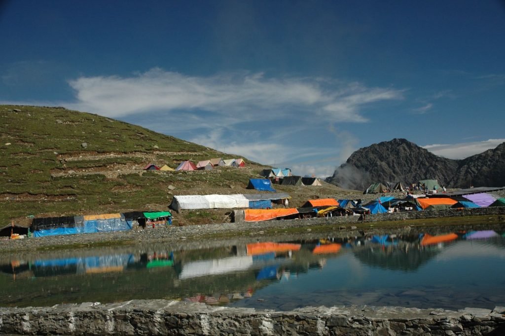
Featured photo: Hiranmay · Original photograph · CC BY-SA 4.0. Displayed at a reduced size.
