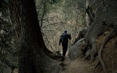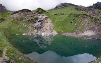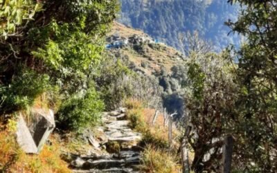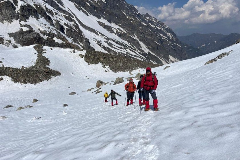
The Jalsu Pass Trek is one of Himachal Pradesh’s lesser-known but genuinely rewarding high-altitude crossings, linking the Chamba valley with the Kangra valley along a route that shepherds and traders have used for generations. The trail climbs through dense deodar and oak forests, crosses open meadows, and crests a mountain pass that offers sweeping views across two of Himachal’s most historically rich districts. Because it sits away from the more commercialised trekking circuits, the Jalsu Pass route retains a quiet, unhurried character that experienced trekkers tend to appreciate.
This is not a beginner’s outing. The ascent to the pass demands steady fitness, a tolerance for variable mountain weather, and the ability to navigate sections where the trail is faint or shared with grazing livestock. That said, trekkers with a reasonable level of hill-walking experience and proper preparation will find the route entirely manageable between June and October, when snow has cleared from the higher sections and the meadows are at their greenest.
The trek carries cultural weight as well as scenic value. Villages along the way belong to communities that have maintained pastoral traditions for centuries, and the landscape shifts noticeably as you cross from the Ravi river drainage on the Chamba side to the Beas river drainage on the Kangra side. This guide covers everything you need to plan the Jalsu Pass Trek responsibly and safely.
Why Jalsu Pass Trek is Famous
The Jalsu Pass Trek is known primarily as an authentic shepherd trail, one that has not been heavily developed for tourism. That authenticity is its main draw. Trekkers who complete the crossing report a strong sense of having walked a living route rather than a packaged experience, with encounters with Gaddi shepherds and their flocks being a regular feature of the journey.
The pass itself sits at a significant elevation and marks the watershed boundary between Chamba and Kangra districts, making it a genuine geographical crossing rather than a simple ridge walk. The views from the top on a clear day extend across forested ridges, distant snowfields, and valley settlements far below. The contrast between the two sides of the pass — the steeper, more rugged Chamba approach and the comparatively gentler Kangra descent — adds variety to the overall experience.
The trek also appeals to those interested in Himachal’s rural culture. The villages near the trailhead and along the route have their own distinct traditions, and the opportunity to observe or interact respectfully with pastoral communities is something that sets this trail apart from more isolated wilderness routes.
About Jalsu Pass Trek
The Jalsu Pass Trek is a point-to-point crossing that begins in or near Chamba town and concludes in the Kangra valley, or can be approached in reverse. The trail follows old pastoral paths that predate modern roads, meaning the route is often narrow, sometimes steep, and occasionally indistinct in open meadow sections. Trekkers should not expect a well-marked, signposted trail throughout.
The terrain changes considerably over the course of the trek. Lower sections pass through forested slopes with good shade and reliable water sources. As the trail climbs, the forest thins and gives way to high-altitude grasslands used as seasonal grazing grounds. The pass itself is typically a broad, open saddle rather than a sharp rocky notch, which makes the crossing feel accessible once you have gained the necessary elevation.
Accommodation along the route is basic. Trekkers should be prepared to camp for at least part of the journey, as permanent guesthouses or teahouses are not consistently available at all stages. Carrying a tent and sleeping gear appropriate for cold nights at altitude is strongly recommended. Hiring a local guide from Chamba is sensible, both for navigation and for understanding local conditions before you set out.
Location of Jalsu Pass Trek
The Jalsu Pass sits on the ridge that separates Chamba district from Kangra district in Himachal Pradesh. The starting point for most trekkers is Chamba town, which lies in the Ravi river valley and serves as the administrative and cultural centre of Chamba district. The pass itself is located in the Dhauladhar range system, which forms the prominent mountain barrier visible from the Kangra valley.
Chamba town is well connected by road to other parts of Himachal Pradesh and serves as a practical base for organising the trek. The Kangra valley end of the route connects to towns and villages that have their own road access, making a one-way crossing with arranged transport at both ends a straightforward logistical option.
The broader region sits within the western Himalaya, and the landscape reflects that position — monsoon-influenced forests on lower slopes, alpine meadows at higher elevations, and a climate that shifts quickly with altitude and season.
Quick Trek Details
| Detail | Information |
|---|---|
| Trek Name | Jalsu Pass Trek – Chamba to Kangra Old Shepherd Trail |
| District / Region | Chamba/Kangra |
| Content Group | Pass Treks |
| Article Type | Pass Trek |
| Starting Point | Chamba |
| Difficulty Level | Moderate |
| Best Time to Visit | June to October |
Trek Route
The general route begins at Chamba town and climbs gradually through forested slopes and small villages before gaining the higher ridgeline that leads to Jalsu Pass. The exact path can vary depending on the season, local conditions, and which village trail your guide uses, so treat the following as a broad outline rather than a fixed itinerary.
From Chamba, the trail initially follows a river valley before turning uphill into deodar forest. Intermediate camping or rest points are typically located at shepherd settlements or open meadow areas, which serve as natural staging posts for the climb. The final push to the pass involves the steepest ascent of the trek and should be attempted in the morning when weather is generally more stable.
The descent on the Kangra side is typically through forested terrain and eventually reaches motorable roads or villages with road access. The exact endpoint varies and should be confirmed with your guide before departure. Trekkers doing the route in reverse — Kangra to Chamba — will find the overall character of the trek similar but the steep section comes earlier in the journey.
Trail conditions change significantly with the monsoon. During July and August, leeches are present on lower forested sections, stream crossings can be higher than expected, and some paths become slippery. June and September to October generally offer the most reliable conditions for this crossing.
Suggested 5-Day Itinerary
This itinerary is a practical framework. Actual daily distances and campsite names should be confirmed with a local guide before departure, as trail conditions and available stopping points vary by season.
Day 1 — Chamba to First Camp: Depart Chamba in the morning after organising supplies and confirming the route with your guide. The first day’s walk climbs through forested terrain and small settlements. Reach the first campsite by early afternoon to allow time to set up before dark. This day is primarily about acclimatisation and settling into the rhythm of the trail.
Day 2 — First Camp to High Meadow Camp: The trail continues to climb, leaving the denser forest behind and entering more open terrain. Shepherd settlements may be encountered along this section. The campsite for the night is typically in a high meadow with good views and access to water. Nights here will be noticeably colder than in Chamba town.
Day 3 — High Meadow Camp to Jalsu Pass and Descent: This is the key day of the trek. Start early to reach the pass before midday, when cloud and wind can build. The views from Jalsu Pass on a clear morning are the highlight of the entire route. After spending time at the top, begin the descent on the Kangra side. Depending on pace, you may camp on the Kangra slope or push further toward lower terrain.
Day 4 — Continued Descent toward Kangra Valley: The descent continues through forest and eventually toward villages with road access. This day is physically easier than the previous two but requires care on steep or wet sections. Water sources are generally reliable on this side of the pass.
Day 5 — Reach Kangra Valley Road Head and Depart: Complete the descent to the road head on the Kangra side. Arrange onward transport in advance, as options from remote trailheads can be limited. If you have a buffer day built into your schedule, this is a good point to use it if the descent took longer than expected.
How to Reach Jalsu Pass Trek Starting Point
By Road
Chamba is connected by road to Pathankot, Dharamshala, and other major towns in Himachal Pradesh and Punjab. Himachal Road Transport Corporation buses operate services to Chamba from several regional hubs, and private taxis are available from Pathankot and Dharamshala. Road journey times vary depending on the season and road conditions; mountain roads in this region can be affected by landslides during the monsoon, so always check current road status before travelling. The drive from Pathankot to Chamba takes approximately four to five hours under normal conditions.
By Air
The nearest airport with regular commercial services is Gaggal Airport near Dharamshala (Kangra Airport), which has connections to Delhi. From Gaggal, Chamba is accessible by road via Dharamshala and Dalhousie, a journey of several hours depending on the route taken. Pathankot also has a small airstrip, but commercial services are limited and should be confirmed before planning travel around them. From the Kangra valley side, Gaggal Airport is the most practical air access point.
By Train
The nearest broad-gauge railway station to Chamba is Pathankot, which is well connected to Delhi, Amritsar, and other major cities. From Pathankot, buses and taxis run to Chamba. The narrow-gauge Kangra Valley Railway connects Pathankot to Jogindernagar and passes through the Kangra valley, which is useful if you are planning to exit the trek on the Kangra side. Train schedules and availability should be confirmed through the Indian Railways website or at the station before travel.
Best Time to Visit Jalsu Pass Trek
The Jalsu Pass Trek is open from June to October. June marks the beginning of the viable trekking window, when snow has typically cleared from the pass and the trail is accessible. The meadows are fresh and green in June and early July, and the weather is generally clear in the mornings before afternoon cloud builds.
July and August bring the monsoon to this region. The trek is technically possible during this period, but trekkers should be prepared for rain, leeches on lower forested sections, slippery trails, and the possibility of stream levels being higher than usual. Visibility at the pass can be poor during heavy monsoon spells. Experienced trekkers who are comfortable with wet conditions can still complete the route, but it requires more caution and flexibility.
September and October are widely considered the best months for this trek. The monsoon withdraws, skies clear, and the light on the mountains is excellent. Temperatures are cooler at altitude, particularly at night, but daytime conditions are comfortable for walking. October can see early snowfall at higher elevations, so trekkers planning a late October crossing should monitor weather forecasts carefully and be prepared to turn back if conditions deteriorate.
Difficulty Level of Jalsu Pass Trek
The Jalsu Pass Trek is rated Moderate. This means it is suitable for trekkers who have some prior hill-walking or trekking experience and a reasonable level of cardiovascular fitness. It is not recommended as a first-ever trek, particularly because sections of the trail are not clearly marked and the route involves sustained climbing over multiple days.
The main physical demands are the cumulative elevation gain over the first two days and the steep final push to the pass on day three. Descending on the Kangra side is less demanding in terms of altitude but requires care on steep or loose sections. Carrying a loaded backpack over this terrain adds to the effort, which is one reason why hiring a porter or pack animal for heavy gear is worth considering.
Trekkers should be comfortable camping in cold conditions, managing their own water supply, and making sensible decisions about weather and turnaround points. The moderate rating assumes good preparation; under-prepared trekkers may find the route significantly harder than expected.
Food, Water and Stay Options
Food options along the Jalsu Pass Trek are limited. Chamba town has a good range of restaurants and shops where you can stock up on supplies before departure. Along the trail itself, small dhabas or tea stalls may be available at some village points, but these cannot be relied upon consistently. Carrying sufficient dry food, snacks, and cooking supplies for the full duration of the trek is the safest approach.
Water is generally available from streams and natural sources along the route, particularly on the forested lower sections and near shepherd camps. However, water from natural sources should be treated before drinking. Carry a reliable water purification method — tablets, a filter, or a UV pen — and do not assume that mountain water is automatically safe to drink without treatment.
Accommodation is primarily camping. There are no established guesthouses or teahouses at the higher sections of the route. Some villages near the trailhead on both the Chamba and Kangra sides may offer basic homestay accommodation, but availability is not guaranteed and should be confirmed locally before you depend on it. Carry a tent, sleeping bag rated for cold temperatures, and a sleeping mat as standard equipment for this trek.
Mobile Network and Facilities
Mobile network coverage on the Jalsu Pass Trek is unreliable and should not be counted on for communication or navigation once you are away from Chamba town. Coverage may be available at some village points along the lower sections of the trail, but it typically disappears as you gain altitude. BSNL tends to have the widest coverage in remote Himachal Pradesh areas compared to private operators, but even this is not consistent on this route.
There are no ATMs, medical facilities, or emergency services along the trail itself. Carry sufficient cash before leaving Chamba, as there will be no opportunity to withdraw money on the route. A basic first aid kit is essential, and trekkers with any medical conditions should consult a doctor before undertaking this trek. Informing someone reliable — a guesthouse owner in Chamba, a family member, or a local contact — of your planned route and expected return date is a sensible safety measure.
Things to Carry for Jalsu Pass Trek
- Sturdy trekking boots with good ankle support and grip
- Tent suitable for mountain conditions
- Sleeping bag rated for temperatures below freezing at altitude
- Sleeping mat or insulated pad
- Trekking poles (particularly useful on steep descents)
- Waterproof rain jacket and rain cover for backpack
- Warm layers including a fleece or down jacket for evenings and mornings
- Moisture-wicking base layers
- Sun hat, sunglasses with UV protection, and sunscreen
- Warm hat and gloves for higher elevations and cold nights
- Water bottles or hydration bladder (minimum two litres capacity)
- Water purification tablets, filter, or UV pen
- Sufficient dry food, energy bars, and cooking supplies for the full trek duration
- Lightweight camping stove and fuel
- Headlamp with spare batteries
- Basic first aid kit including blister treatment, pain relief, and altitude sickness awareness supplies
- Personal medications in adequate supply
- Leech socks or salt for monsoon-season trekking
- Map of the area or downloaded offline maps
- Fully charged power bank
- Emergency whistle
- Sufficient cash for the entire trip
- Photocopies of identification documents
Safety Tips for Jalsu Pass Trek
Hire a local guide from Chamba before starting this trek. The trail is not consistently marked, and sections across open meadows and near the pass can be difficult to follow without local knowledge. A guide also provides valuable information about current conditions, water sources, and safe camping spots.
Start the pass crossing early on the day you plan to summit. Mountain weather in this region typically deteriorates in the afternoon, with cloud, wind, and occasional thunderstorms developing after midday. Reaching the pass by late morning gives you time to cross safely and begin the descent before conditions worsen.
Do not push on if weather is clearly deteriorating. Building a buffer day into your itinerary means you have the option to wait out bad weather at a campsite rather than feeling pressured to continue in unsafe conditions. A flexible schedule is a genuine safety asset on this kind of trek.
Acclimatise properly. The trek gains significant altitude over a relatively short distance. If you feel symptoms of altitude sickness — persistent headache, nausea, dizziness, or difficulty breathing at rest — descend immediately and do not attempt to continue upward until symptoms have fully resolved.
Inform someone of your plans. Before leaving Chamba, tell your guesthouse, a local contact, or a family member your intended route, daily stopping points, and expected return date. This information is critical if a search is ever needed.
Carry more food and water than you think you need. On a route with limited resupply options, running short of either is a serious problem. Err on the side of carrying extra weight rather than cutting supplies too fine.
Respect the trail and the communities along it. Do not camp in areas that are clearly used as water sources for villages. Carry all waste out with you. Ask permission before photographing people or their homes.
Nearby Places to Visit
Chamba Town
Chamba is one of Himachal Pradesh’s most historically significant towns, with a collection of ancient temples, a riverside chaugan (open ground), and a local museum that documents the region’s art and history. The Lakshmi Narayan temple complex and the Chamunda Devi temple are among the most visited sites. Spending a day exploring Chamba before or after the trek is time well used.
Khajjiar
Often described as a small meadow lake surrounded by forest, Khajjiar lies roughly an hour’s drive from Chamba and is one of the most visited spots in the district. The combination of a natural lake, open grassland, and deodar forest makes it a pleasant half-day excursion. It is accessible by road and requires no trekking.
Dalhousie
The hill station of Dalhousie is within reasonable driving distance of Chamba and offers a different character — colonial-era architecture, pleasant walking paths, and views toward the Pir Panjal range. It is a useful base for acclimatisation before the trek or a comfortable place to recover afterward.
Dharamshala and McLeod Ganj
On the Kangra side of the pass, Dharamshala and the upper town of McLeod Ganj are major destinations in their own right. McLeod Ganj is the seat of the Tibetan government in exile and has a distinct cultural character, with Tibetan monasteries, markets, and cafes. It is easily accessible from the Kangra valley and makes a natural endpoint or extension to a Jalsu Pass crossing.
Kangra Fort
One of the largest forts in the Himalayan region, Kangra Fort sits above the Banganga and Manjhi rivers near Kangra town. It has a long and complex history and is worth visiting for its scale and the views it offers across the valley. The fort is accessible by road from Kangra town and is a short detour if you are passing through the area after completing the trek.
Google Maps Location
Search for Chamba, Himachal Pradesh on Google Maps to locate the trek starting point. For the pass itself, search for Jalsu Pass, Himachal Pradesh. Downloading offline maps of the Chamba and Kangra districts before departure is strongly recommended, as mobile data connectivity along the route is unreliable. Apps such as Maps.me or the offline function in Google Maps allow you to save map data for use without a signal.
Responsible Travel Tips
Carry all non-biodegradable waste out of the mountains with you. Plastic bottles, wrappers, and packaging should be packed out and disposed of properly in Chamba or at the Kangra end of the route. Do not leave waste at campsites, near water sources, or along the trail.
Use established campsites where they exist rather than creating new ones. Repeated camping in the same spot causes less cumulative damage to vegetation than spreading out across pristine meadow areas.
Keep water sources clean. Do not wash with soap or detergent directly in streams or near natural water points. Carry water at least fifty metres from the source before washing, and use biodegradable soap in minimal quantities.
Respect the Gaddi shepherds and other communities you encounter on the trail. Ask before photographing people, do not enter private property without invitation, and be mindful that these are working landscapes, not tourist attractions. Purchasing locally made goods or food where available is a direct way to support the communities along the route.
Stick to the established trail. Cutting switchbacks and creating new paths accelerates erosion on steep mountain slopes. Follow the existing route even when shortcuts look tempting.
If you hire a guide or porter, pay a fair wage and treat them with respect. Local knowledge and labour are what make treks like this possible, and the people who provide these services deserve proper compensation and consideration.