Thamsar Pass Trek is one of the most remote and challenging treks in Himachal Pradesh. Located in the Dhauladhar range, this route connects the Kangra side with the legendary Bara Bhangal village, one of the most isolated villages in the region.
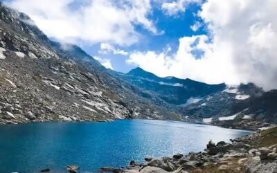
This is not a beginner trek. Thamsar Pass is a high-altitude crossing with steep climbs, long walking days, rocky sections, snowfields in some seasons and very limited facilities. The route passes through village trails, forest patches, alpine meadows, glacial lake areas and exposed mountain terrain before reaching the pass.
For experienced trekkers who want to explore the deeper Dhauladhar landscape and the old shepherd routes of Himachal, Thamsar Pass is a serious and unforgettable journey. It should be planned with local guides, proper gear, enough buffer days and clear weather windows.
Why Thamsar Pass Trek is Famous
Thamsar Pass is famous because it is one of the classic shepherd routes of the Dhauladhar range. For generations, local Gaddi shepherds have used such high mountain routes to move between valleys and grazing grounds.
The trek is also known for its remote character. Unlike popular trails near McLeod Ganj, Thamsar Pass takes trekkers into a quieter and more isolated part of Himachal. Once you move beyond the lower villages and meadows, the landscape becomes wild, open and demanding.
Bara Bhangal adds even more importance to the trek. The village is remote, culturally distinct and surrounded by high mountains. Reaching it on foot gives trekkers a rare glimpse of an older Himalayan way of life.
About Thamsar Pass Trek
Thamsar Pass lies in the Dhauladhar range and is commonly associated with the route towards Bara Bhangal village. The trek is usually approached from the Kangra side through Bir, Billing, Rajgundha and Palachak side, or as part of longer Bara Bhangal trekking routes.
The route climbs gradually from lower village areas towards higher meadows, campsites and rocky terrain before crossing Thamsar Pass. The pass itself is a serious high-altitude crossing, often mentioned around 4,735 to 4,800 metres above sea level.
The trek can take around 5 to 7 days or more depending on the chosen route, pace, weather and whether the itinerary includes Bara Bhangal and exit options towards other valleys. Because of remoteness, it should never be planned casually or without proper local support.
Location of Thamsar Pass Trek
Thamsar Pass Trek is located in the Dhauladhar range of Himachal Pradesh. The route connects the Kangra side with the Bara Bhangal region, which lies in the remote upper mountain belt between Kangra and Chamba side landscapes.
Nearest major town: Bir / Baijnath / Dharamshala side
Nearest tourist base: Bir Billing / Rajgundha side
District region: Kangra and Bara Bhangal region
Mountain range: Dhauladhar Range
Main route side: Bir Billing – Rajgundha – Palachak – Thamsar Pass – Bara Bhangal
Nearest airport: Gaggal Airport near Dharamshala
Nearest major railway side: Pathankot, followed by road travel towards Kangra / Baijnath / Bir side
Quick Trek Details
| Detail | Information |
|---|---|
| Trek Name | Thamsar Pass Trek |
| Location | Dhauladhar range, Himachal Pradesh |
| Main Region | Kangra to Bara Bhangal side |
| Mountain Range | Dhauladhar Range |
| Common Starting Side | Bir Billing / Rajgundha side |
| Common Route | Bir / Billing – Rajgundha – Palachak – Thamsar Pass – Bara Bhangal |
| Common Duration | Around 5 to 7 days or more, depending on itinerary |
| Approximate Trek Distance | Varies widely by route; plan as a multi-day remote trek |
| Difficulty Level | Moderate to difficult / difficult |
| Pass Altitude | Around 4,735 to 4,800 metres approx. |
| Best Time to Visit | Mid-June to mid-October, subject to weather and snow conditions |
| Suitable For | Experienced trekkers with good fitness |
| Family Friendly | Not suitable for casual family trips or small children |
| Guide Requirement | Strongly recommended |
| Nearest Market | Bir / Baijnath / Dharamshala side before the trek |
| Camping Status | Must be planned with local guide/operator and current permissions |
| Avoid During | Heavy rain, snowfall, poor visibility, winter, early-season snow risk and weather warnings |
Trek Route
The common Thamsar Pass route from Kangra side follows this direction:
Bir / Billing → Rajgundha → Palachak side → Higher camps → Thamsar Pass → Bara Bhangal
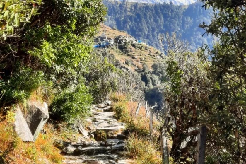
The trek often begins from the Bir Billing or Rajgundha side. The lower section passes through village areas, forest patches and open meadows. This part of the route feels beautiful and peaceful, but it is only the beginning of a much more serious journey.
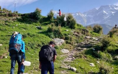
As the trail moves higher from Rajgundha and Palachak side, the terrain becomes more alpine. Forest cover reduces and the landscape opens into meadows, rocky slopes and stream crossings. The walking days become longer, and campsites are basic.
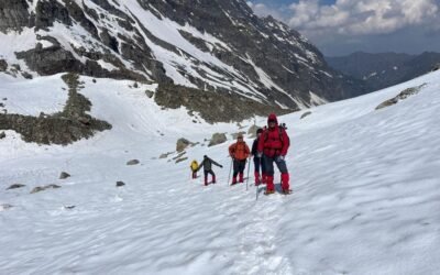
The approach to Thamsar Pass is the toughest part of the trek. Trekkers may face steep ascents, loose stones, scree, snowfields and cold winds near the pass. The route should be attempted early in the day, and only if weather is stable.
After crossing Thamsar Pass, the descent towards Bara Bhangal is also serious. Descending on loose or snowy terrain can be harder than climbing, especially when legs are tired. This section needs patience, proper footwear and guide support.
Suggested 7-Day Itinerary
Day 1: Reach Bir / Billing and move towards Rajgundha side
Arrive at Bir or Billing and continue towards Rajgundha depending on road condition and trek plan. Use this day for preparation, local coordination and checking weather.
Day 2: Rajgundha to Palachak side
Start trekking through village trails, forest patches and open meadows. The route gradually moves into quieter mountain terrain.
Day 3: Palachak side to higher campsite
Continue towards higher camps below Thamsar Pass. The terrain becomes more open and rugged, with fewer facilities and colder conditions.
Day 4: Higher campsite to Thamsar Pass and descend towards Bara Bhangal side
Start very early for the pass crossing. This is the most demanding day of the trek. Cross the pass only in safe weather and descend carefully towards the Bara Bhangal side.
Day 5: Reach / explore Bara Bhangal village
Depending on the campsite and previous day’s progress, continue towards Bara Bhangal village. Keep this day flexible because weather and terrain can slow the group.
Day 6: Buffer or local route day
A buffer day is highly useful on this trek. Use it for rest, weather delays or local movement depending on the exit plan.
Day 7: Begin return or continue exit route as per guide plan
Exit routes from Bara Bhangal depend on season, trail condition and guide arrangement. Do not assume that every route is open. Plan the return or continuation only after confirming current ground conditions.
This itinerary is only a practical structure. Thamsar Pass and Bara Bhangal routes are remote, and final planning should be done with experienced local guides.
How to Reach Thamsar Pass Trek Starting Point
By Road
Bir, Baijnath and Dharamshala are the main approach areas for this trek. Travellers usually reach Bir or Baijnath by road from Delhi, Chandigarh, Punjab or other parts of Himachal Pradesh.
From Bir or Billing side, local transport or trekking arrangements may take you towards Rajgundha or the active starting point, depending on road condition and current route plan.
By Air
Gaggal Airport near Dharamshala is the nearest airport for the Kangra side. From the airport, travellers can travel by road towards Bir, Baijnath or the chosen starting point.
By Train
The nearest major railway access is usually Pathankot side. From Pathankot, travellers continue by road towards Kangra, Baijnath, Bir or Dharamshala side.
Best Time to Visit Thamsar Pass Trek
The best time for Thamsar Pass Trek is generally mid-June to mid-October, depending on snow, weather and trail conditions.
Early season can have snow on the pass and upper sections. Monsoon can bring rain in lower regions, slippery trails, swollen streams and landslide risk. September and early October are often preferred by experienced trekkers because weather may be clearer after the monsoon, but nights become colder.
This trek should not be attempted in winter or unsafe snow conditions. Always check local weather, route condition and pass status before starting.
Difficulty Level of Thamsar Pass Trek
Thamsar Pass Trek is generally considered moderate to difficult, and for many trekkers it feels difficult because of remoteness and long walking days.
The challenge is not only altitude. The trek includes steep ascents, rocky and scree sections, possible snowfields, stream crossings, cold campsites and limited facilities. Help is not easily available once you move into the remote sections.
This trek is best suited for experienced trekkers who have already done multi-day Himalayan treks. It is not recommended for complete beginners.
Food, Water and Stay Options
Food and stay options are available before the trek around Bir, Baijnath and nearby villages. Once the trek begins, facilities become limited and eventually very basic.
Food should be arranged through a local guide or trekking operator. Carry personal snacks, but do not depend on shops or cafes on the upper route.
Water sources may be available in mountain sections, but they vary by season and campsite. Use water only after checking with your guide.
Camping is part of this trek, but campsites must be chosen carefully. Do not pitch tents randomly near streams, unstable slopes or sensitive grazing areas.
Mobile Network and Facilities
Mobile network may work around Bir, Billing, Rajgundha or lower village areas, but it becomes unreliable or unavailable on the higher route.
Do not depend on mobile signal for safety. Inform family or friends before starting the trek and share your planned itinerary with them.
Facilities are extremely limited after the lower villages. Trekkers should be prepared for basic camping, no toilets, no shops, no electricity and limited emergency access.
Things to Carry for Thamsar Pass Trek
For Thamsar Pass Trek, carry proper high-altitude trekking gear:
- Good trekking shoes with ankle support and strong grip
- Warm layers and insulated jacket
- Windproof and waterproof outer layer
- Rain protection or poncho
- Gloves and woollen cap
- Sunglasses and sun cap
- Water bottle or hydration bladder
- Energy bars, dry fruits and personal snacks
- Personal medicines
- Basic first-aid kit
- Trekking poles
- Headlamp with extra batteries
- Power bank
- Sunscreen and lip balm
- Small garbage bag to bring waste back
- Valid ID proof
- Sleeping bag suitable for cold conditions
- Camping gear if not arranged by operator
Pack carefully. This is not a trail where missing gear can easily be bought after starting.
Safety Tips for Thamsar Pass Trek
Take a local guide or experienced trekking operator. This route is remote, and local knowledge is important for trail navigation, campsite selection and weather judgement.
Start early on pass-crossing day. High passes are safer in the morning when weather is usually more stable.
Do not attempt the pass in poor visibility, snowfall, heavy rain, thunderstorm or strong wind.
Walk slowly on scree and boulder sections. Loose rocks can slip and injure people below you.
Keep buffer days. Remote treks can be delayed by weather, stream crossings, route damage or group health issues.
Watch for altitude-related discomfort. Headache, dizziness, nausea, unusual breathlessness or confusion should not be ignored.
Do not split the group in remote sections. Stay together and follow the guide’s pace.
Respect local shepherd routes, grazing grounds and village customs.
Nearby Places to Visit
Bir Billing
Bir Billing is famous for paragliding, monasteries, cafes and mountain views. It is often used as an approach side for the Thamsar Pass route.
Rajgundha Valley
Rajgundha is a scenic valley and village area between Bir Billing and Barot side. It is a beautiful base for easier hikes and nature walks.
Bara Bhangal
Bara Bhangal is one of the most remote villages in Himachal Pradesh. It is the main highlight of this route and is reached only through demanding mountain trails.
Baijnath Temple
Baijnath Temple is an important ancient Shiva temple near the Kangra side. It can be visited before or after the trek.
Barot Valley
Barot Valley is known for river scenery, forest surroundings and peaceful mountain atmosphere. Some routes and travel plans connect this broader region with trekking circuits.
Google Maps Location
For navigation, search:
Thamsar Pass, Himachal Pradesh
You can also search:
Rajgundha, Himachal Pradesh
or
Bara Bhangal, Himachal Pradesh
Google Maps routes in this region can be approximate and should not be treated as final trekking navigation. Always confirm the active route with local guides before starting.
Responsible Travel Tips
Thamsar Pass and Bara Bhangal lie in a fragile and remote mountain region. Waste management is difficult here, so trekkers must be extra careful.
Do not throw plastic bottles, food packets, wet wipes, cigarette waste or batteries on the trail. Carry your waste back to a proper disposal point.
Avoid loud music and unnecessary disturbance. The route is used by shepherds, villagers, trekkers and wildlife.
Respect local culture in Bara Bhangal and nearby villages. Ask before photographing people, homes or religious spaces.
Use local guides, porters and homestays where possible. Responsible trekking should support the people who live in these remote areas.
FAQs About Thamsar Pass Trek
Is Thamsar Pass Trek suitable for beginners?
No, Thamsar Pass Trek is not suitable for complete beginners. It is a remote high-altitude trek with long walking days, steep sections and limited facilities.
How many days are needed for Thamsar Pass Trek?
Most trekkers need around 5 to 7 days or more, depending on route, weather, campsite plan and exit option. Buffer days are strongly recommended.
What is the altitude of Thamsar Pass?
Thamsar Pass is usually mentioned at around 4,735 to 4,800 metres above sea level. Altitude figures may vary slightly between sources.
What is the best time for Thamsar Pass Trek?
Mid-June to mid-October is generally considered the main trekking window, subject to snow and weather conditions. September and early October are often preferred by experienced trekkers.
Is a guide required for Thamsar Pass Trek?
Yes, a guide is strongly recommended. The route is remote, high-altitude and weather-sensitive, with limited facilities and difficult navigation in bad conditions.
Can Thamsar Pass Trek be done from Bir Billing?
Yes, many routes approach Thamsar Pass from the Bir Billing and Rajgundha side before moving towards Bara Bhangal. Exact starting point depends on road condition and current trail status.
Is Thamsar Pass Trek safe?
Thamsar Pass Trek is safe only with proper planning, good weather, strong fitness, local guidance and suitable gear. It becomes risky during snowfall, heavy rain, poor visibility, altitude sickness or careless route decisions.
Last Word
Thamsar Pass Trek is one of Himachal’s serious Dhauladhar routes. It is remote, demanding and deeply rewarding for trekkers who are prepared for long days, high altitude and basic conditions.
This trek is not about quick sightseeing. It is about patience, endurance, local guidance and respect for the mountains. Plan it carefully, keep buffer days, listen to your guide and never force the pass in bad weather.
With the right preparation, Thamsar Pass can become one of the most powerful trekking experiences in Himachal Pradesh.
Fact-check note: Trek distance, altitude, route status, weather, food availability, camping rules and local restrictions can change. Visitors should verify current conditions locally before starting the trek.